Takeoff Spot Elevations
Spot elevations are points that represent the geographic topography of the site. MudShark gives you two ways to takeoff spot elevations.
Tip: You don’t need to enter whole numbers, you can use decimals for accuracy, like 0.1 or 0.75.
Takeoff Spot Elevations from a Layer
If the plan you want to takeoff spot elevations from is a DWG or DXF file, you might be able to use Transmute for a layer to automatically takeoff all spots. This will require the DWG or DXF plan to have a layer with only points or symbols representing spot points and 3D information about those spots, specifically altitudes. If your plan fulfils the criteria, using Transmute on a layer is the fastest way to takeoff spot elevations.
To Transmute a spot elevation layer:
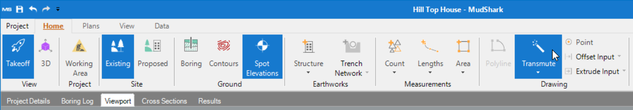
1. From the Home tab in the ribbon, select Existing or Proposed to determine the site your spots will be added to.
2. From the Ground group in the ribbon, click Spot Elevations.
3. From the Drawing group in the ribbon, click Transmute.
4. From the Plans pane, expand the DWG or DXF plan which has the spots you want to takeoff.
5. Click the layer that contains the spot elevations.
Tip: Use the visibility options to ensure you have the right layer for your spot elevations.
6. The Transmute window will open, telling you how many layers or points MudShark will transmute.
7. Click Transmute.
Takeoff Spot Elevations Indivisualfrom a Layer
No matter what type of plan you’re using, you can always takeoff spot elevations one-at-a-time with Point.
To enter spot elevations:
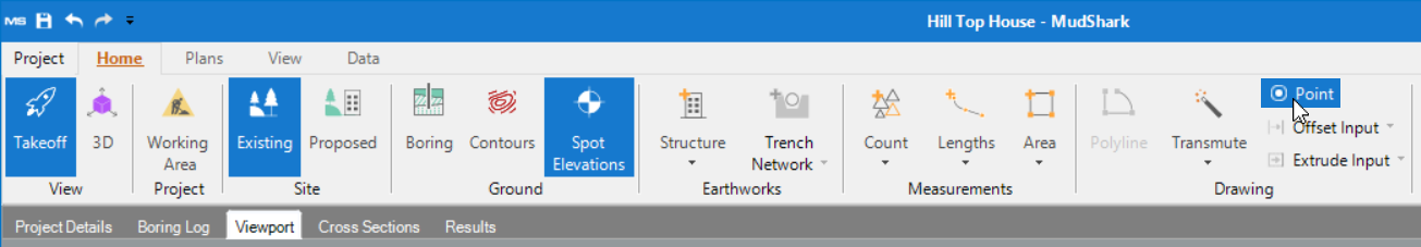
1. From the Home tab in the ribbon, select Existing or Proposed to determine the site your contours will be added to.
2. From the Ground group in the ribbon, click Contours.
3. From the Drawing group in the ribbon, click Point.
4. From the Task panel, enter your Next altitude, which will be the altitude of the spot you enter next.
5. From the Viewport, click the spot locations are at the altitude you entered.
6. Using your keyboard, type the altitude for the next spot elevation you intend to takeoff, this value will be displayed in the Task panel in the Next altitude.
7. Continue entering the spot elevations you wish to use for calculation.